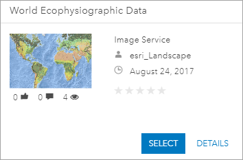
Esri hosts and maintains weighted overlay services that represent physiographic and ecological data at a global scale. You can use these services in ArcGIS GeoPlanner to identify locations based on your criteria and answer geographic questions.

You may want to perform analysis using datasets that represent different criteria. Your organization can host its data on ArcGIS Enterprise or ArcGIS Online in a weighted overlay service. You can then consume that service in GeoPlanner for suitability modeling. This allows you to share your data and analysis with specific groups, organizations, or the public.
Configuration
Hosted weighted overlay services are built from mosaic datasets that are shared as image services. This functionality uses various ArcGIS tools and components. You'll need the following components to set up a weighted overlay service.
- You must have at least one of the following:
- Enterprise with ArcGIS Image Server 10.8.1 or later
- ArcGIS Image for ArcGIS Online
- ArcGIS Image Dedicated
- ArcGIS Pro
- Weighted Raster Overlay Service toolbox
- If you're going to use the service in GeoPlanner, you must have one or both of the following:
- ArcGIS Online organization with a named user license for GeoPlanner
- Enterprise organization with a named user license for GeoPlanner
- You must have at least one of the following:
- ArcGIS Web AppBuilder with the Suitability Modeler widget
- ArcGIS Experience Builder with the Suitability Modeler widget
- GeoPlanner
There are three general workflows to configure and share your weighted overlay service: prepare your data, add your data to a mosaic dataset, and publish your data as a weighed overlay service. The Weighted Raster Overlay Service toolbox contains analysis tools that will help you prepare and configure your data for a weighted overlay service. It is recommended that you use these tools, as they will apply the proper fields, properties, and metadata to your raster layers and mosaic dataset.
Prepare your data
The first step is to prepare your data for weighted overlay analysis. Because weighted overlay services are based on raster layers, you may need to convert existing vector data to raster data. Additionally, you can check your layers’ geometry, projections, and extents to ensure that the individual layers in the mosaic will align.
Learn more about preparing your data for weighted overlay analysis
Add your data to a mosaic dataset
A mosaic dataset contains the layers that you will use in your weighted overlay service. Using the tools from the toolbox, you can create a mosaic with your raster layers, update the layer classifications within that mosaic, and provide appropriate metadata for the mosaic.
Publish your data as a weighted overlay service
To make your mosaic dataset available as a weighted overlay service, you must share it as an image service and provide necessary metadata so it can be used as a modeling service. Adding a weightedOverlayService tag to the item in your organization allows GeoPlanner to identify it as a weighted overlay modeling service.
Learn more about publishing your data as a weighted overlay service