With Esri Roads and Highways for Server, you can do the following:
Publish networks and event layers as a map service
Using Esri Roads and Highways for Server, you can publish your LRS Networks and registered event layers as a map service. As a map service, your linear referenced data can be shared to the enterprise and published to your organizational account at ArcGIS Online. Networks and events can be consumed by any client app that can consume an ArcGIS Server map service, including existing ArcGIS Desktop web and mobile clients. In addition, web developers can use the ArcGIS Server Web APIs to develop web and connected mobile apps against your linear referenced data.
Compatibility with desktop solutions
Use the following details to install and maintain desktop clients that are compatible with your Roads and Highways for Server installation.
Compatibility with ArcMap
It is recommended that ArcMap, including the Esri Roads and Highways for Desktop extension, and ArcGIS Enterprise, including the Roads and Highways for Server extension, be the same version.
Compatibility with ArcGIS Pro
The Roads and Highways functionality in ArcGIS Pro requires Location Referencing services available from ArcGIS Enterprise. ArcGIS Pro and ArcGIS Enterprise must be installed to compatible versions.
注:
The Roads and Highways functionality is included in ArcGIS Pro and does not require a separate installation but requires the Location Referencing license feature.
Use the following matrix as a guideline:
| ArcGIS Pro version | ArcGIS Enterprise version |
|---|---|
2.6 | 10.8.1 |
2.5 | 10.8 |
2.4 | 10.7.1 |
Add the Linear Referencing capability to map services
Roads and Highways for Server extends the existing ArcGIS Server map service with an additional REST service capability for linear referencing. These additional REST services, provided by Roads and Highways for Server, support the following capabilities:
- Provide LRS-based network and event layer information
- Translate coordinate locations to routes and measures
- Translate (Locate) routes and measures to coordinates or polylines
- Validate route and measure values
- Convert measures from one LRM to another
- Multilayer, transactional event editing, with support for overlap retirement and coincident event merging
Roads and Highways provides online developer help for REST services exposed by the Linear Referencing capability.
Learn more about the Linear Referencing Service REST API and enabling the linear referencing capability.
Provides JavaScript web developer samples

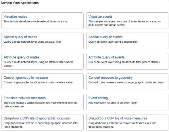
To demonstrate the pattern of use of the REST services exposed by Roads and Highways for Server, the server product comes packaged with JavaScript developer samples. These developer samples demonstrate how a web or connected mobile developer would do the following:
- Visualize networks on a map
- Visualize events on a map
- Locate measures on a route
- Perform spatial and attribute queries for routes
- Perform spatial, measure, and attribute queries for events
- Convert routes and measures to coordinates
- Convert coordinates to routes and measures
- Convert measures between linear referencing methods (LRMs)
Roads and Highways provides online hosted versions of these developer samples.
Edit event data on the web using Event Editor

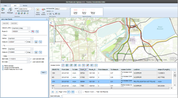
Event Editor is a web app provided by Roads and Highways for Server that supports editing of event data in a web browser.
Produce reports using Roadway Reporter
Roadway Reporter for Esri Roads and Highways is a web app powered by Roads and Highways for Server that allows you to create mileage and road segment reports from a mapcentric user experience. Roadway Reporter allows you to configure, save, and share reports and supports generating reports to either Adobe PDF format or CSV files that can be manipulated further in Microsoft Excel.