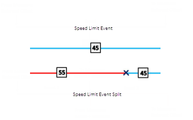
The Split Events tool is used to split a line event into two adjoining events. You can edit the attributes of the split events before selecting the location to split. On successful implementation, the resulting split events get new event IDs, and the input event retires.

注:
If a line event that uses the referent offsets method to get the start and end measure values is split into two adjoining events, the resulting split events get new event IDs, and the original event retires. The first event will retain the referent offset method value for the start measure value, but will use the route and measure method to get the new end measure value. The second event will use the route and measure method to get the start measure value and will use the referent offset method value as its end measure value.
- 打开 Event Editor 并在出现提示时登录到您的 ArcGIS 组织。
- 单击编辑选项卡。
- In the Edit Events group, click the Split Events button
 .
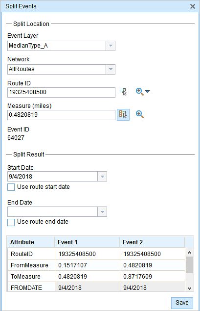
.The Split Events widget appears.
- In the Split Location section, choose an event layer on which to work by clicking the Event Layer drop-down arrow.

- The LRM to which the event is registered is automatically specified under the Network option, but you can choose the LRM by clicking the drop-down arrow.
- Type a route ID in the Route ID text box on which the new event measure will be based.
- Click the Select From Measure on the Map button
 to select a point on an event from the selected route.
The event will be split into two events on either side of the point. Alternatively, you can type a measure value in the text box. The event underlying the measure value of the route will be split into two.
The records/attributes of the split event appear in the Split Result area.
- 单击开始日期和结束日期日历控件以选择事件的开始日期和结束日期。
开始日期默认为今天的日期,也可以使用日期选择器选择不同的日期。 结束日期也可选。
- 可以编辑白色的字段。
The gray fields are disabled and not editable.
注:
配置属性值表中的任何字段时,支持编码值属性域和范围属性域以及子类型。
- Click Save to split the records.
编辑事件保存后,将在右下角显示一条确认消息。
提示:
也可以单击在地图上选择路径按钮  以在地图上选择路径。