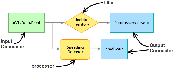
Once the necessary Input Connectors and Output Connectors are created, you can drag and drop elements onto the canvas and connect them to create a GeoEvent Service. The workflow is similar to ModelBuilder in ArcGIS for Desktop, only rather than working with geoprocessing elements, you work with GeoEvent Service elements (for example, inputs, outputs, filters, and processors).

Step-by-step instructions illustrating how to create a GeoEvent Service can be found in the Introduction to GeoEvent Extension tutorial. Access the tutorial from GeoEvent Extension tutorials.