Web scene layers are cached web layers that are optimized for displaying a large number of features and can be viewed in Scene Viewer and ArcGIS Pro. Scene layers include the following types:  3D object,
  building,
  integrated mesh,
  point, and
  point cloud layers. When sharing a scene layer, a feature layer that is used to generate the cache is also shared.
Scene layers can be shared to an ArcGIS Enterprise portal using a scene layer package generated from ArcGIS Pro, or you can publish 3D data from ArcGIS Pro. When you publish directly from ArcGIS Pro, it creates a feature layer and scene layer in your portal.
When you publish 3D data, you have two options for the feature layer:
- Copy the feature data, which creates a hosted feature layer. Hosted feature layers and hosted scene layers are related; if you delete the scene layer, the hosted feature layer is also deleted.
- Leave the feature data in your registered data source, which creates an ArcGIS Server feature layer. Creating a feature layer that references your registered data can help improve publishing performance because the feature data isn't copied. However, the two layers are no longer as closely related; when you delete the scene layer, the feature layer is not deleted.
3D object
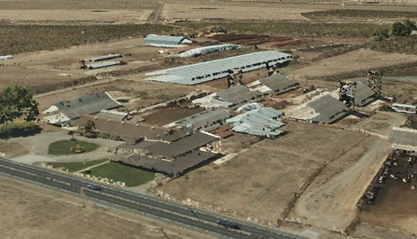
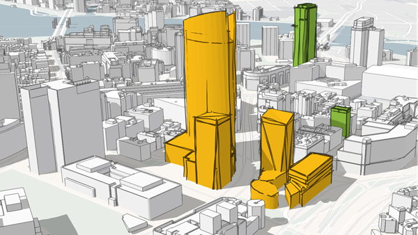
3D object scene layers can be used to represent and visualize 3D objects, such as textured or untextured buildings that are modeled in 3D. From ArcGIS Pro, you can create a 3D object scene layer from multipatch data published directly to ArcGIS Enterprise either as a web scene layer with an associated feature layer or from a scene layer package (SLPK). Finally, Esri CityEngine 2016.0 and later can export an SLPK from which you can publish a 3D object scene layer.
Building
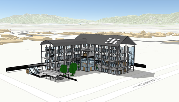
Building scene layers allow you to visualize complex digital models of buildings and interact with all the components of the building. With building scene layers, you can explore a building's composition, properties, and location of structures within a building digital model. Building scene layers allow you to query and isolate discipline layers—such as structural or architectural—or categories, such as walls or roofs. They are used widely for engineering, architecture, surveying, and construction purposes. You can publish a building scene layer from ArcGIS Pro 2.3 or later as an SLPK.
Integrated mesh
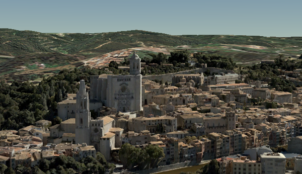
Integrated mesh data is typically captured by an automated process for constructing 3D objects from large sets of overlapping imagery. The result integrates the original input image information as a textured mesh using a triangular interlaced structure. An integrated mesh includes elevation information and can represent built and natural 3D features, such as building walls, trees, valleys, and cliffs, with realistic textures. Integrated mesh scene layers are generally created for citywide 3D mapping and can be created using Drone2Map for ArcGIS and ArcGIS Pro 2.2 and later releases, which can then be shared to an ArcGIS Enterprise 10.5 or later release portal as an SLPK.
Point
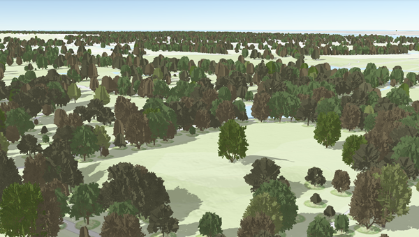
To ensure fast visualization in all clients, cached point scene layers are used to display large amounts of point data not possible with a point feature layer. Point scene layers are automatically thinned to improve performance and visibility at smaller scales. Automatic thinning means that not all features are displayed at small scales; as you zoom in, additional features are displayed. For example, you may use a point scene layer to display all the trees in a city. From ArcGIS Pro, you can create a point scene layer from a feature layer shared directly to ArcGIS Enterprise as a web scene layer.
Point cloud
Point cloud scene layers allow fast consumption and display of large volumes of point cloud data in Scene Viewer and ArcGIS Pro 1.4 or later. You can also configure these layers in ArcGIS Pro and publish them to the ArcGIS Enterprise portal. Point cloud scene layers in Scene Viewer can appear different based on the symbology renderer type configured from ArcGIS Pro. Scene Viewer supports the following renderer types from ArcGIS Pro:
- Stretch
- Classify
- Unique Values
- RGB
